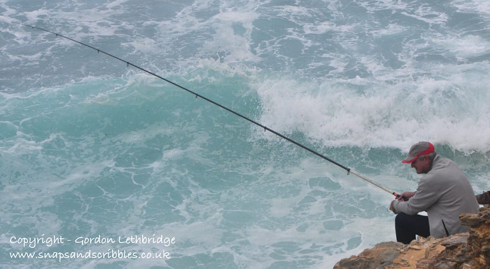
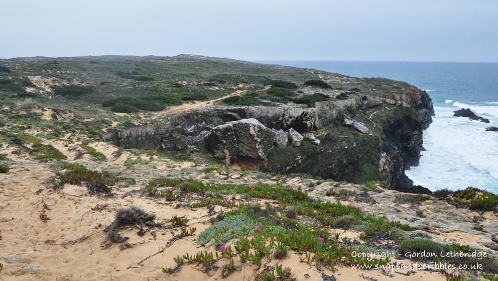
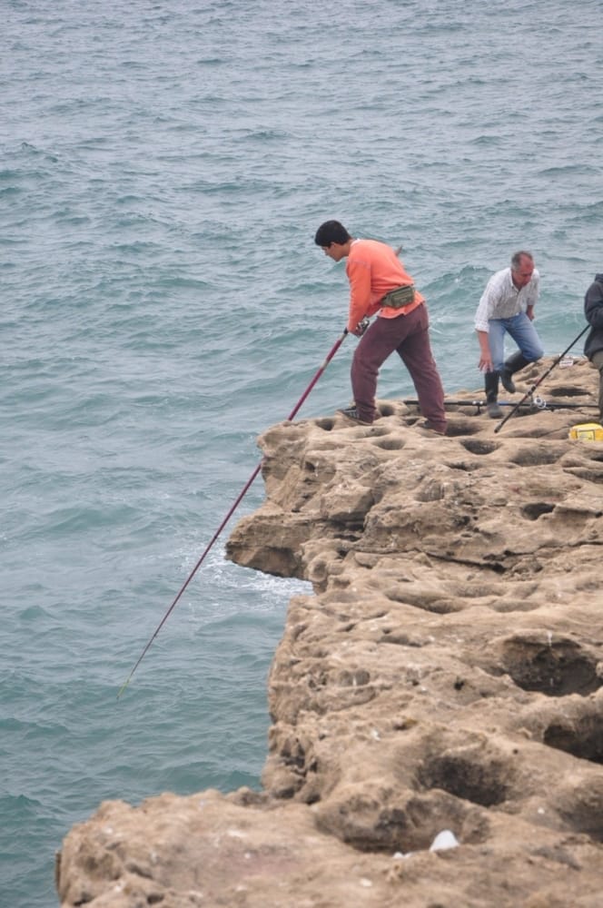
The day was overcast and the waves rolled in from the Atlantic relentlessly pounding the sandstone cliffs. Spray rose several metres into the air. Perched on the very edges of the cliffs fishermen stood with their lines cast down to the maelstrom of white, gray and blue swirling beneath them. It was obvious now why the sandy trail along the cliffs was called the Fisherman’s Trail.
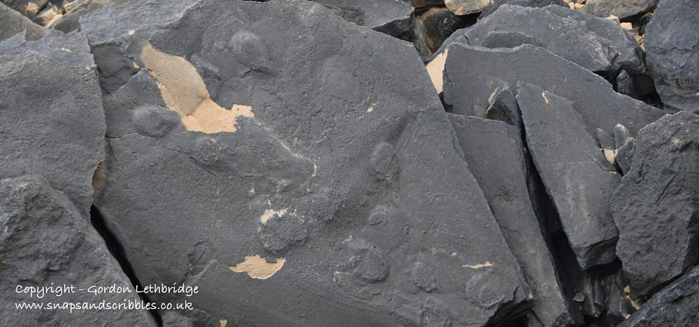
Jose, our guide, took us to the edge to peer over at the rocks below. Huge chunks of cliff the size of a London bus lay at the foot of the cliffs where they had fallen. He pointed out one rock that with large circular “footprints” across it. Those, he said, had been identified as the footprints of elephants; proof that elephants had once roamed Portugal. It was quite convincing tale but I was slightly skeptical. They certainly looked like the elephant footprints I have seen in Zimbabwe, Botswana and Malawi. Was it a bit of good-natured leg pulling? Time to head for Google…
…okay, so there are several reputable scientific sources that report elephant footprints along the Atlantic coast of Portugal.
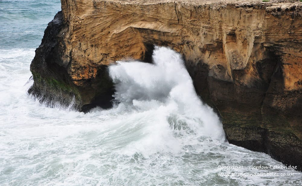
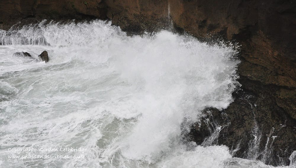
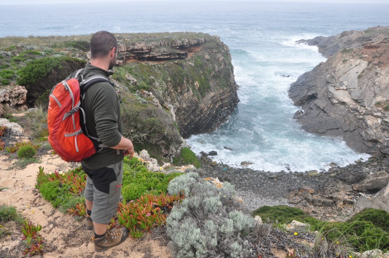
We continued our hike along the path above many little coves and inaccessible bays. All the time the air was laden with sea spray as each breaker pounded against the rocks and sent spray high into the air.
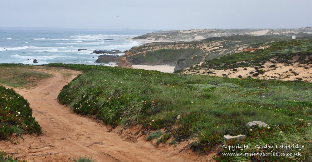
It was spring and the cracks, the sand filled depressions and heathland were covered in a profusion of wildflowers. It is a wonder anything survives in the harsh cliff top conditions but the flowers were well adapted to the wind and salt. For 300 out of the 365 days of the year the sun shines along this coast. That means another extreme for the vegetation to cope with, heat.
Although the day I was hiking was blustery and over cast it is the exception rather then the rule as it is in the UK. Most hikers who choose to tackle the path do so from late spring right through to the end of June and again from September onwards. It’s just too hot in July and August.
Portugal faces west with nothing between it and the Americas. It takes the full force of the Atlantic breakers as they make landfall. This makes for some seriously dramatic coastline; none more so than the Alentejo south of Sines and from there to Cabo Sao Vicente, Portugal’s Land’s End. There are dramatic cliffs and sweeping bays with only a few small fishing villages to break up the littoral and it is mostly undiscovered except for by local fishermen, a few surfers and hikers.
Rota Vicentina is a 340km long distance foot path from Cape St Vincent to Santiago do Cacem through Portugal’s Algarve and Alentejo. It consists of two routes, the Fisherman’s Trail and the Historical Way. The Fisherman’s Trail, as the name would suggest, follows the coast while the Historical Way follows rural tracks further inland.
The Fisherman’s Trail consists of several small loops in the southern part of the Rota Vicentina and one longer 4 to 5 day itinerary along the coast further north and is around 122km in length.
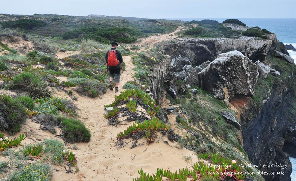
In one of the guidebooks to the path it warns that the Fisherman’s Trail is tougher than it’s parallel, inland alternative the Historical Way. There are dunes behind the cliffs and for the most part you are walking on soft sand and rock. This makes it tough on the thighs and ankles. The same guidebook warned that the Fisherman’s Trail is not for those who suffer from vertigo.
It was not long before I discovered why. The route follows old fishermen’s paths which of necessity followed the cliff edge closely. There were times when the path edge and the cliff edge were one and the same. I am not a vertigo sufferer but I nearly became one at one stage.
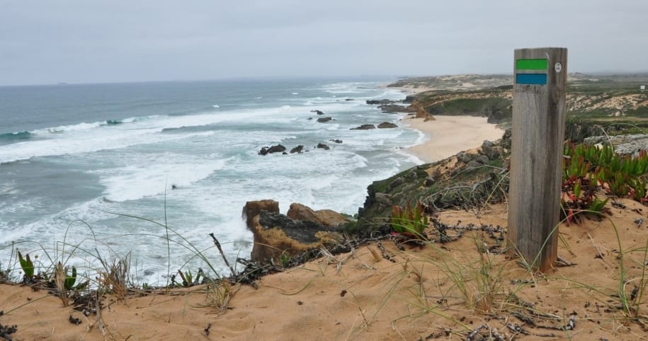
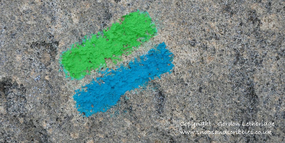
The cliff tops are crisscrossed with tracks and it would be easy to lose your way. However, the trail is one of the best way-marked tracks I have come across anywhere in the world. All way-mark posts are kept low for minimal visual environmental impact and are made of wood for the same reason. A blue and green stripe identify the route; representing the colours of the vegetation and the sea.
There are extensive guides and maps to the route but the way-marking is so good these could languish at the bottom of a day pack for the duration of the hike. At each stage, usually at a car park or small village there are detailed information boards with an indication of what you are likely to see.
The path is maintained mostly by local volunteers and our guide had a small repair kit in his backpack with which to repair and replace any damaged way-markers. Those locals who regularly walk the path carry out these maintenance tasks and pick up what little litter is left behind.
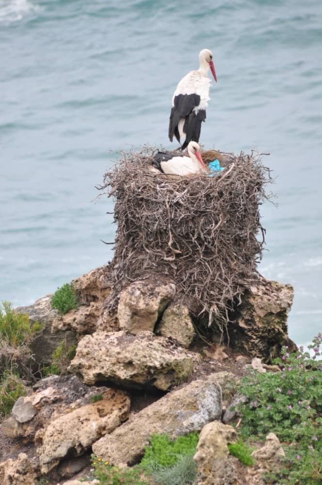
We kept a look out for peregrine falcons hunting the rock pigeons, and the swifts but only came across storks nesting with young. Human beings would pay premium prices for a detached property with a sea view like some of the nest sites.
As we continued along the narrow trail with steep slopes above and vertical cliffs plummeting into the roiling sea I was glad to learn that there was good news during the economic downturn. Plans to build a golf course along the coast and elsewhere a resort had to be cancelled as finances dried up. This gave breathing space for others more concerned with conservation time to get the coastline and its environment protected. The Fisherman’s Trail now runs through protected land and is visited by an increasing number of international walkers who bring much needed money into the local economy in one of Europe’s poorer regions
Have you hiked the Rota Vicentina? Please share with us your experiences.
Addendum February 3 2016: Since writing this post CaminoWay.com have introduced tours walking the Fishermen’s Trail. Prices start at €580 for 6 nights and €996 for 10 nights on a bed and breakfast basis. Luggage is transferred each day.
Sunvil Discovery can book a walking holiday along the Alentejo Coast staying in handpicked accommodation close to the path and can arrange for your luggage to be transported ahead. You can also find an Alentejo walking holiday with Responsible Travel that follows much of the Fishermen’s Path starting at £320 (€390) for 8 days excluding flights.
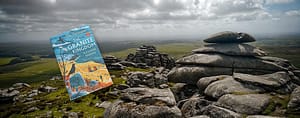
The Rota Vicentina website has detailed information in English on the Historical Way and the Fisherman’s Trail and is very useful in planning any trip. An English language guide to the Fishermen’s Path can be downloaded from the Rota Vicentina website. The guide includes detailed maps, photographs and descriptions. It is free to download.
For more information visit the Alentejo’s very informative website www.visitalentejo.com
Declaration: I travelled as a guest of Agência de Promoção Turística do Alentejo. As always I retain full editorial control and all opinions are mine.


2 thoughts on “Hiking the Fishermen’s Trail”
Great post Gordon. I’m planning to do this sometime soon and it really is great to see your impressive photos and descriptive story. Thanks!
Thanks Nick for your compliments. I hope that you enjoy the hike and the scenery as much as I did.
Comments are closed.